Rosneft Starts Geophysical Survey in the Northern Part of the Kara

OAO NK Rosneft started airborne and gravimetric survey field operations in the Central Arctic Region and the North Kara Sea License Area. Rosneft’s joint venture partner for exploration of the North Kara Sea License Areas is ExxonMobil.
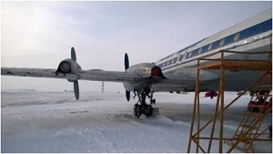
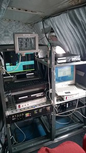
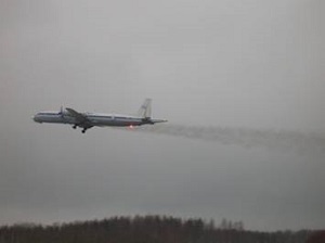
 The License Area covering 196,000 square meters is surveyed from aircraft with special-purpose onboard equipment (aerial magnetometer and aerial gravimeter) and navigation systems supporting comprehensive geophysical studies of the North Kara License Area. The said operations also rely on the base ground instruments used to obtain high-quality data and ensure the accuracy of the design airborne survey profiles. Considering the remoteness and considerable size of the area, the aircraft has to meet higher flying range specifications.
The airborne, gravimetric, and magnetic surveys are an effective method for exploring geological composition of oil and gas basins, and such surveys are conducted prior to a full-scale seismic survey. The equipment deployed on board the aircraft measures the intensity and direction of geo-magnetic and gravity fields indicative of the rock properties in the area under survey. The use of the method gives the benefit of early exploration startup because it allows for surveying above the ice cover without the use of marine vessels.
OAO NK Rosneft is conducting the surveys in full compliance with the Russian Federation environmental protection law. The airborne, gravimetric, and magnetic surveys will make no adverse impact on the natural environment in the Arctic. The project operations are managed by Rosneft subsidiary, OOO RN Arctic Shelf.
In the summer of 2013, a Kara-Summer-2013 research expedition completed comprehensive research program covering the Kara Sea hydrological and metocean conditions, channel glacier monitoring of the Novaya Zemlya archipelago, and full analysis of the local ice conditions. The Program execution involved 12 marine and 3 aircraft vessel, unmanned aircraft, subsea and surface standalone stations, and satellite monitoring systems.
 Concurrent geological exploration is in progress in the southern part of the Kara Sea, in the Vostochno – Prinovozemelsky-1, 2, and 3 License Areas, where a large scope of seismic, engineering, environmental protection, and other operations was completed in the last two years. In 2014, the plan is to drill the first exploration/appraisal well, Universitetskaya-1 into the structure of the same name within the Vostochn-Prinovozemelsky-1 License Area, a year earlier than required by the license.
Notes for Editors:
Rosneft was granted a license for hydrocarbon exploration and production in the North Kara Area in 2013; the area covers 196 thousand square kilometers.
The sea depth within the area boundaries varies from 10 to 545 meters; ice conditions are challenging (the sea is covered with ice from 270 to 300 days a year); winter temperature, down to minus 46˚С; ice thickness, 1.2 to 1.6 meters.
Arctic development will generate the demand for products of other industries, which will stimulate social and economic development not only in Russia’s northern regions, but also in its multiple industries.
Rosneft
Information Division
April 28, 2014