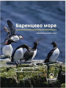
Rosneft’s Environmental Atlas Wins ESRI Competition

A map from the Barents Sea Environmental Atlas, a joint project of Rosneft Oil Company and Innopraktika, has been awarded the ESRI Map Gallery International Annual Competition. ESRI is the creator of the world’s leading international mapping platform. The map was developed by specialists from the Lomonosov Moscow State University Marine Research Centre and reflects the species diversity of marine mammals in the Barents Sea.
The Barents Sea Atlas was published in 2020 as a collection of research data on physical geography, oceanology, hydrometeorology and the environment. The atlas features over 55 thematic schematic maps of the waters and coastal zone of the Barents Sea, many charts, schemes, summary tables and artistic illustrations. The atlas reflects the results of Rosneft’s many years of research and development activities. The data collected helped update the previously known information and add to the current understanding of the state of environment. The atlas also presents the results of the Company’s work on marine mammals, the polar bear and walrus. The aim of this programme is to study rare animal species that are bio-indicators of the state of Arctic ecosystems. It contains unique artistic illustrations, maps and photographs from the Company’s expeditions. The atlas was designed by specialists from the Company’s Arctic Research Centre and the nation’s leading institutions.
The atlas is available for free download: Atlas of the Barents Sea
Rosneft
Information Division
February 3, 2022